trafficnow has been dedicated to real-time traffic information for more than a decade, and offers the best in roadside detection by combining vehicle tracking systems with data collection and vehicle classification.
BLUETOOTH MAC CAPTURE
Detecting hands-free sets, audio devices, phones and other Bluetooth devices through inquiry is the most classic vehicle tracking method.
WI-FI MAC CAPTURE
Capturing broadcast messages from SmartPhones and other Wi-Fi devices adds more samples, and is a good add-on to BT.
BLE MAC CAPTURE
Bluetooth Low Energy is, by far, the most efficient technology at this time. Devices like SmartWatches, AirPods, FitBits and more use BLE. The advertisement packages transmitted are also the fastest to detect.
Roadside products
DEEPBLUE VIA
DeepBlue VIA is a Video Image Analyser that uses object recognition to accurately count and track the mobility in a limited area, for instance around an intersection.
An NVIDIA Graphical Processing Unit allows using our powerful deep learning algorithms to recognize, count and classify not just the cars, vans and trucks, but also buses, motorbikes, bicycles and pedestrians.
DEEPBLUE V-MODEL
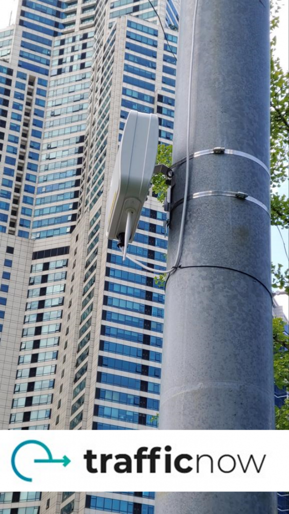
The DeepBlue V-model – a unique small roadside sensor for Bluetooth, BLE and Wi-Fi tracking.
The ideal maintenance-free, non-intrusive sensor for getting online travel time information and origin/destination information for improved infrastructure planning.
DEEPBLUE D-MODEL
The DeepBlue D-model – a unique roadside sensor for Bluetooth, BLE and Wi-Fi tracking with specially designed antennas for covering up to 16 lanes of traffic from the side of the road.
The ideal maintenance-free, non-intrusive sensor for getting online travel time information and origin/destination information for improved infrastructure planning.
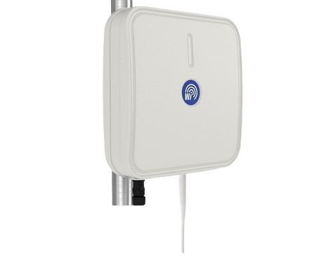
DEEPBLUE S-MODEL
The DeepBlue S-model – a unique small roadside sensor for Bluetooth, BLE and Wi-Fi tracking.
The ideal maintenance-free, non-intrusive sensor for getting online travel time information and origin/destination information for improved infrastructure planning.